Číhalín | |
|---|---|
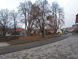 Centre of Číhalín | |
 Flag  Coat of arms | |
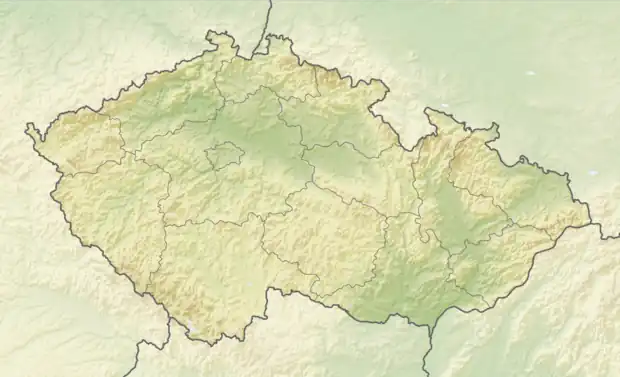 Číhalín Location in the Czech Republic | |
| Coordinates: 49°16′7″N 15°48′43″E / 49.26861°N 15.81194°E | |
| Country | |
| Region | Vysočina |
| District | Třebíč |
| First mentioned | 1538 |
| Area | |
| • Total | 6.34 km2 (2.45 sq mi) |
| Elevation | 489 m (1,604 ft) |
| Population (2023-01-01)[1] | |
| • Total | 238 |
| • Density | 38/km2 (97/sq mi) |
| Time zone | UTC+1 (CET) |
| • Summer (DST) | UTC+2 (CEST) |
| Postal code | 675 07 |
| Website | www |
Číhalín is a municipality and village in Třebíč District in the Vysočina Region of the Czech Republic. It has about 200 inhabitants.
Číhalín lies approximately 8 kilometres (5 mi) north-west of Třebíč, 22 km (14 mi) south-east of Jihlava, and 136 km (85 mi) south-east of Prague.
History
The first written mention of Číhalín is from 1538.[2]
References
- ↑ "Population of Municipalities – 1 January 2023". Czech Statistical Office. 2023-05-23.
- ↑ "O obci" (in Czech). Obec Číhalín. Retrieved 2022-10-21.
Wikimedia Commons has media related to Číhalín.
This article is issued from Wikipedia. The text is licensed under Creative Commons - Attribution - Sharealike. Additional terms may apply for the media files.