| Belaya Kholunitsa | |
|---|---|
 | |
| Native name | Белая Холуница (Russian) |
| Location | |
| Country | Russia |
| Physical characteristics | |
| Mouth | Vyatka |
• coordinates | 58°41′55″N 50°13′25″E / 58.69861°N 50.22361°E |
| Length | 168 km (104 mi) |
| Basin size | 2,800 km2 (1,100 sq mi) |
| Basin features | |
| Progression | Vyatka→ Kama→ Volga→ Caspian Sea |
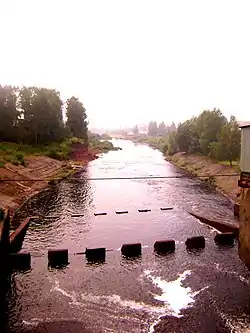
Belaya Kholunitsa (Russian: Бе́лая Холуни́ца) is a river in Kirov Oblast in Russia, a left tributary of the Vyatka. It is 168 kilometres (104 mi) long, and the area of its drainage basin is 2,800 square kilometres (1,100 sq mi).[1]
The Belaya Kholunitsa has its sources in the Upper Kama Upland, and flows through a flat landscape. The river is frozen over from November to April. It is used for floating of timber.
The town of Belaya Kholunitsa is situated by the river.
References
- ↑ «Река Белая Холуница», Russian State Water Registry
This article is issued from Wikipedia. The text is licensed under Creative Commons - Attribution - Sharealike. Additional terms may apply for the media files.