Brooks Crossroads, North Carolina | |
|---|---|
 Location of Brooks Crossroads in North Carolina  Brooks Crossroads, North Carolina (the United States) | |
| Coordinates: 36°07′12″N 80°46′23″W / 36.12000°N 80.77306°W | |
| Country | United States |
| State | North Carolina |
| County | Yadkin |
| Elevation | 1,089 ft (332 m) |
| Time zone | UTC-5 (Eastern (EST)) |
| • Summer (DST) | UTC-4 (EDT) |
| ZIP code | 27020[2] |
| Area code | 336 |
| FIPS code | 37-37197 |
| GNIS feature ID | 981978[1] |
| Other names | Brooks Cross Roads Centre Hill[1] |
Brooks Crossroads, also called Brooks Cross Roads, is an unincorporated community in Yadkin County, North Carolina, United States on U.S. Highway 421, east of Interstate 77.
References
- 1 2 3 U.S. Geological Survey Geographic Names Information System: Brooks Crossroads, North Carolina. Retrieved on 2008-03-22.
- ↑ "Brooks Cross Roads NC". ZIP Code Lookup. Retrieved June 9, 2008.
Municipalities and communities of Yadkin County, North Carolina, United States | ||
|---|---|---|
| Towns | 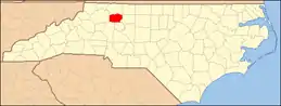 Map of North Carolina highlighting Yadkin County | |
| Townships | ||
| CDP | ||
| Other communities | ||
This article is issued from Wikipedia. The text is licensed under Creative Commons - Attribution - Sharealike. Additional terms may apply for the media files.