Butler Township | |
|---|---|
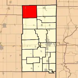 Location in Vermilion County | |
| Coordinates: 40°25′49″N 87°50′51″W / 40.43028°N 87.84750°W | |
| Country | United States |
| State | Illinois |
| County | Vermilion |
| Created | 1840 |
| Area | |
| • Total | 71.92 sq mi (186.3 km2) |
| • Land | 71.91 sq mi (186.2 km2) |
| • Water | 0 sq mi (0 km2) 0% |
| Elevation | 735 ft (224 m) |
| Population (2010) | |
| • Estimate (2016)[1] | 947 |
| • Density | 13.8/sq mi (5.3/km2) |
| Time zone | UTC-6 (CST) |
| • Summer (DST) | UTC-5 (CDT) |
| ZIP codes | 60932, 60942, 60960, 60963, 61865 |
| Area code | 217 |
| FIPS code | 17-183-10162 |
Butler Township is a township in Vermilion County, Illinois, USA. As of the 2010 census, its population was 992 and it contained 459 housing units.[2]
History
The township was formed from a portion of Middlefork Township in 1840 and was named after General Benjamin F. Butler, a civil war hero.[3]
Geography
According to the 2010 census, the township has a total area of 71.92 square miles (186.3 km2), all land.[2]
Cities and towns
Unincorporated towns
Extinct towns
- Hustle
- Pellville
- Reilly
Adjacent townships
- Fountain Creek Township, Iroquois County (north)
- Lovejoy Township, Iroquois County (northeast)
- Grant Township (east)
- Ross Township (east)
- Middlefork Township (south)
- Kerr Township, Champaign County (southwest)
- Button Township, Ford County (west)
- Pigeon Grove Township, Iroquois County (northwest)
Cemeteries
The township contains three cemeteries: East Lynn, Pellville and Rankin.
Major highways
Airports and landing strips
- Russells Airport
Demographics
| Census | Pop. | Note | %± |
|---|---|---|---|
| 2016 (est.) | 947 | [1] | |
| U.S. Decennial Census[4] | |||
School districts
- Hoopeston Area Community Unit School District 11
- Paxton-Buckley-Loda Community Unit School District 10
- Rossville-Alvin Community Unit School District 7
Political districts
- Illinois' 15th congressional district
- State House District 105
- State Senate District 53
References
- 1 2 "Population and Housing Unit Estimates". Retrieved June 9, 2017.
- 1 2 "Population, Housing Units, Area, and Density: 2010 - County -- County Subdivision and Place -- 2010 Census Summary File 1". United States Census. Archived from the original on February 12, 2020. Retrieved May 28, 2013.
- ↑ Stapp, Katherine; W. I. Bowman (1968). History Under Our Feet: The Story of Vermilion County, Illinois. Danville, Illinois: Interstate Printers and Publishers, Inc. p. 41.
- ↑ "Census of Population and Housing". Census.gov. Retrieved June 4, 2016.
External links
Municipalities and communities of Vermilion County, Illinois, United States | ||
|---|---|---|
| Cities | Map of Illinois highlighting Vermilion County | |
| Villages | ||
| Townships | ||
| CDPs | ||
| Other communities | ||
| Footnotes | ‡This populated place also has portions in an adjacent county or counties | |
This article is issued from Wikipedia. The text is licensed under Creative Commons - Attribution - Sharealike. Additional terms may apply for the media files.