08°17′02″S 49°14′49″W / 8.28389°S 49.24694°W
Couto Magalhães | |
|---|---|
| The Municipality of Couto Magalhães | |
 Flag  Seal | |
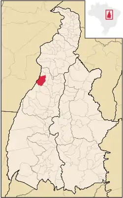 Location of Couto Magalhães in the State of Tocantins | |
 | |
| Country | |
| Region | North |
| State | |
| Area | |
| • Total | 1,586 km2 (612.4 sq mi) |
| Elevation | 230 m (750 ft) |
| Population (2020 [1]) | |
| • Total | 5,639 |
| • Density | 3.07/km2 (8/sq mi) |
| Time zone | UTC−3 (BRT) |
| Human Development Index | 0.628 [2] |
Couto Magalhães is a municipality located in the Brazilian state of Tocantins. Its population was 5,639 (2020) and its area is 1,586 km² (612.4 mi²), a density of 3.07 people/km² (8 people/mi²). It is located 150 m (492.1 ft) above sea level.[3] The demonym is Coutense.[4]
References
- ↑ "IBGE 2020". Retrieved 26 January 2021.
- ↑ "Archived copy". Archived from the original on 2009-10-03. Retrieved 2009-12-17.
{{cite web}}: CS1 maint: archived copy as title (link) - ↑ "CityBrazil - Tocantins - Couto de Magalhães". Archived from the original on 2011-05-24. Retrieved 2008-12-23.
- ↑ IBGE - "Archived copy". Archived from the original on June 11, 2008. Retrieved June 11, 2008.
{{cite web}}: CS1 maint: archived copy as title (link)
This article is issued from Wikipedia. The text is licensed under Creative Commons - Attribution - Sharealike. Additional terms may apply for the media files.