Crécy-sur-Serre | |
|---|---|
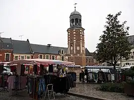 The old belfry of Crécy-sur-Serre | |
.svg.png.webp) Coat of arms | |
Location of Crécy-sur-Serre | |
 Crécy-sur-Serre  Crécy-sur-Serre | |
| Coordinates: 49°41′52″N 3°37′24″E / 49.6978°N 3.6233°E | |
| Country | France |
| Region | Hauts-de-France |
| Department | Aisne |
| Arrondissement | Laon |
| Canton | Marle |
| Intercommunality | Pays de la Serre |
| Government | |
| • Mayor (2020–2026) | Bertrand Jonneaux[1] |
| Area 1 | 17.9 km2 (6.9 sq mi) |
| Population | 1,503 |
| • Density | 84/km2 (220/sq mi) |
| Time zone | UTC+01:00 (CET) |
| • Summer (DST) | UTC+02:00 (CEST) |
| INSEE/Postal code | 02237 /02270 |
| Elevation | 57–133 m (187–436 ft) (avg. 62 m or 203 ft) |
| 1 French Land Register data, which excludes lakes, ponds, glaciers > 1 km2 (0.386 sq mi or 247 acres) and river estuaries. | |
Crécy-sur-Serre (French pronunciation: [kʁesi syʁ sɛʁ], literally Crécy on Serre) is a commune in the Aisne department in Hauts-de-France in northern France.[3]
Population
| Year | Pop. | ±% p.a. |
|---|---|---|
| 1968 | 1,598 | — |
| 1975 | 1,594 | −0.04% |
| 1982 | 1,700 | +0.92% |
| 1990 | 1,542 | −1.21% |
| 1999 | 1,550 | +0.06% |
| 2009 | 1,454 | −0.64% |
| 2014 | 1,487 | +0.45% |
| 2020 | 1,499 | +0.13% |
| Source: INSEE[4] | ||
See also
References
- ↑ "Répertoire national des élus: les maires" (in French). data.gouv.fr, Plateforme ouverte des données publiques françaises. 4 May 2022.
- ↑ "Populations légales 2021". The National Institute of Statistics and Economic Studies. 28 December 2023.
- ↑ Commune de Crécy-sur-Serre (02237), INSEE
- ↑ Population en historique depuis 1968, INSEE
Wikimedia Commons has media related to Crécy-sur-Serre.
This article is issued from Wikipedia. The text is licensed under Creative Commons - Attribution - Sharealike. Additional terms may apply for the media files.