Hanover Township | |
|---|---|
 Scenery at the Wapello Land and Water Reserve | |
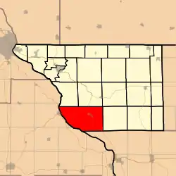 Location in Jo Daviess County | |
 Jo Daviess County's location in Illinois | |
| Coordinates: 42°14′38″N 90°18′05″W / 42.24389°N 90.30139°W | |
| Country | United States |
| State | Illinois |
| County | Jo Daviess |
| Established | November 2, 1852 |
| Government | |
| • Supervisor | Janice R. Steele |
| Area | |
| • Total | 56.83 sq mi (147.2 km2) |
| • Land | 52.1 sq mi (135 km2) |
| • Water | 4.73 sq mi (12.3 km2) 8.32% |
| Elevation | 876 ft (267 m) |
| Population (2010) | |
| • Estimate (2016)[1] | 1,142 |
| • Density | 23.1/sq mi (8.9/km2) |
| Time zone | UTC-6 (CST) |
| • Summer (DST) | UTC-5 (CDT) |
| ZIP codes | 61028, 61041, 61074 |
| FIPS code | 17-085-32720 |
Hanover Township is one of twenty-three townships in Jo Daviess County, Illinois, USA. As of the 2010 census, its population was 1,201 and it contained 689 housing units.[2]
Geography
According to the 2010 census, the township has a total area of 56.83 square miles (147.2 km2), of which 52.1 square miles (135 km2) (or 91.68%) is land and 4.73 square miles (12.3 km2) (or 8.32%) is water.[2]
Cities, towns, villages
Cemeteries
The township contains Lost Mound Cemetery.
Major highways
Rivers
Landmarks
- Lock and Dam No. 12 of the Mississippi River.
- Savanna US Army Depot.
Demographics
| Census | Pop. | Note | %± |
|---|---|---|---|
| 2016 (est.) | 1,142 | [1] | |
| U.S. Decennial Census[3] | |||
School districts
- River Ridge Community Unit School District 210.
Political districts
- Illinois' 16th congressional district.
- State House District 89.
- State Senate District 45.
References
- "Hanover Township, Jo Daviess County, Illinois". Geographic Names Information System. United States Geological Survey, United States Department of the Interior. Retrieved January 17, 2010..
- United States Census Bureau 2007 TIGER/Line Shapefiles.
- United States National Atlas.
- 1 2 "Population and Housing Unit Estimates". Retrieved June 9, 2017.
- 1 2 "Population, Housing Units, Area, and Density: 2010 - County -- County Subdivision and Place -- 2010 Census Summary File 1". United States Census. Archived from the original on February 12, 2020. Retrieved May 28, 2013.
- ↑ "Census of Population and Housing". Census.gov. Retrieved June 4, 2016.
External links
- Jo Daviess County official site.
- City-Data.com.
- Illinois State Archives.
- Township Officials of Illinois.
Places adjacent to Hanover Township, Jo Daviess County, Illinois | |
|---|---|
Municipalities and communities of Jo Daviess County, Illinois, United States | ||
|---|---|---|
| Cities | Map of Illinois highlighting Jo Daviess County | |
| Villages | ||
| Townships | ||
| CDPs | ||
| Other unincorporated communities | ||
| Ghost town | ||
This article is issued from Wikipedia. The text is licensed under Creative Commons - Attribution - Sharealike. Additional terms may apply for the media files.