Horný Badín | |
|---|---|
Municipality | |
 Horný Badín Location of Horný Badín in the Banská Bystrica Region  Horný Badín Location of Horný Badín in Slovakia | |
| Coordinates: 48°17′N 19°05′E / 48.283°N 19.083°E | |
| Country | |
| Region | Banská Bystrica |
| District | Krupina |
| First mentioned | 1391 |
| Area | |
| • Total | 5.62[1] km2 (2.17[1] sq mi) |
| Elevation | 311[2] m (1,020[2] ft) |
| Population (2021) | |
| • Total | 178[3] |
| Postal code | 962 51[2] |
| Area code | +421 45[2] |
| Car plate | KA |
| Website | www.hornybadin.dcom.sk |
Horný Badín (Hungarian: Felsőbágyon) is a village and municipality in the Krupina District of the Banská Bystrica Region of Slovakia.
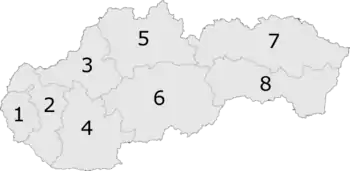
6: Banská Bystrica Region
Genealogical resources
The records for genealogical research are available at the state archive "Statny Archiv in Banska Bystrica, Slovakia"
- Roman Catholic church records (births/marriages/deaths): 1800-1895 (parish B)
- Lutheran church records (births/marriages/deaths): 1786-1895 (parish B)
See also
References
- 1 2 "Hustota obyvateľstva - obce [om7014rr_ukaz: Rozloha (Štvorcový meter)]". www.statistics.sk (in Slovak). Statistical Office of the Slovak Republic. 2022-03-31. Retrieved 2022-03-31.
- 1 2 3 4 "Základná charakteristika". www.statistics.sk (in Slovak). Statistical Office of the Slovak Republic. 2015-04-17. Retrieved 2022-03-31.
- ↑ "Počet obyvateľov podľa pohlavia - obce (ročne)". www.statistics.sk (in Slovak). Statistical Office of the Slovak Republic. 2022-03-31. Retrieved 2022-03-31.
External links
This article is issued from Wikipedia. The text is licensed under Creative Commons - Attribution - Sharealike. Additional terms may apply for the media files.