Jurgaičiai | |
|---|---|
Village | |
 | |
 Jurgaičiai Location in Lithuania 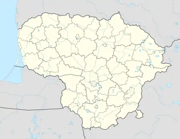 Jurgaičiai Jurgaičiai (Lithuania) | |
| Coordinates: 55°21′11″N 23°40′59″E / 55.35306°N 23.68306°E | |
| Country | |
| County | |
| Municipality | Kėdainiai district municipality |
| Eldership | Krakės Eldership |
| Population (2011) | |
| • Total | 7 |
| Time zone | UTC+2 (EET) |
| • Summer (DST) | UTC+3 (EEST) |
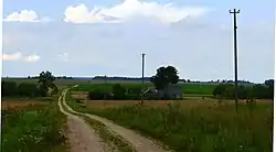
Jurgaičiai (formerly Polish: Jurgajcie,[1] Russian: Юргайци) is a village in Kėdainiai district municipality, in Kaunas County, in central Lithuania. According to the 2011 census, the village had a population of 7 people.[2] It is located 1.5 kilometres (0.93 mi) from Pajieslys, in the Pajieslys Geomorphological Sanctuary.
At the beginning of the 20th century Jurgaičiai was an okolica, a property of the Bagdonavičiai, Ylėnai, Kelčiauskai, Krasaučiai, Kutkevičiai, Mikulšiai, Milaševičiai, Paškevičiai and Aleknavičiai families.[1]
Archaeologist Laima Vaitkunskienė led excavations examining medieval cemeteries in the area.[3]
Demography
|
| ||||||||||||||||||||||||||||||
| Source: 1902, 1923, 1959 & 1970, 1979, 1989, 2001, 2011 | |||||||||||||||||||||||||||||||
References
- 1 2 "Jurgajcie". Geographical Dictionary of the Kingdom of Poland (in Polish). 15 pt. 2. Warszawa: Kasa im. Józefa Mianowskiego. 1902. p. 31.
- ↑ "2011 census". Statistikos Departamentas (Lithuania). Retrieved August 21, 2017.
- ↑ "Laima Vaitkunskienė". www.vle.lt (in Lithuanian). Retrieved 2023-02-08.
This article is issued from Wikipedia. The text is licensed under Creative Commons - Attribution - Sharealike. Additional terms may apply for the media files.