Le Lardin-Saint-Lazare | |
|---|---|
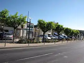 A view within Le Lardin | |
 Coat of arms | |
Location of Le Lardin-Saint-Lazare | |
 Le Lardin-Saint-Lazare  Le Lardin-Saint-Lazare | |
| Coordinates: 45°07′50″N 1°13′39″E / 45.1306°N 1.2275°E | |
| Country | France |
| Region | Nouvelle-Aquitaine |
| Department | Dordogne |
| Arrondissement | Sarlat-la-Canéda |
| Canton | Haut-Périgord Noir |
| Government | |
| • Mayor (2020–2026) | Francine Bourra[1] |
| Area 1 | 10.85 km2 (4.19 sq mi) |
| Population | 1,665 |
| • Density | 150/km2 (400/sq mi) |
| Time zone | UTC+01:00 (CET) |
| • Summer (DST) | UTC+02:00 (CEST) |
| INSEE/Postal code | 24229 /24570 |
| Elevation | 79–246 m (259–807 ft) (avg. 86 m or 282 ft) |
| 1 French Land Register data, which excludes lakes, ponds, glaciers > 1 km2 (0.386 sq mi or 247 acres) and river estuaries. | |
Le Lardin-Saint-Lazare is a commune in the Dordogne department in Nouvelle-Aquitaine in southwestern France. Condat-Le Lardin station has rail connections to Bordeaux, Périgueux and Brive-la-Gaillarde.
Population
| Year | Pop. | ±% |
|---|---|---|
| 1962 | 1,636 | — |
| 1968 | 1,761 | +7.6% |
| 1975 | 1,982 | +12.5% |
| 1982 | 2,037 | +2.8% |
| 1990 | 2,047 | +0.5% |
| 1999 | 1,854 | −9.4% |
| 2008 | 1,937 | +4.5% |
See also
References
- ↑ "Répertoire national des élus: les maires". data.gouv.fr, Plateforme ouverte des données publiques françaises (in French). 9 August 2021.
- ↑ "Populations légales 2021". The National Institute of Statistics and Economic Studies. 28 December 2023.
Wikimedia Commons has media related to Le Lardin-Saint-Lazare.
This article is issued from Wikipedia. The text is licensed under Creative Commons - Attribution - Sharealike. Additional terms may apply for the media files.