Maury, North Carolina | |
|---|---|
 Maury  Maury | |
| Coordinates: 35°28′45″N 77°35′25″W / 35.47917°N 77.59028°W | |
| Country | United States |
| State | North Carolina |
| County | Greene |
| Area | |
| • Total | 1.05 sq mi (2.73 km2) |
| • Land | 1.05 sq mi (2.73 km2) |
| • Water | 0.00 sq mi (0.00 km2) |
| Elevation | 66 ft (20 m) |
| Population (2020) | |
| • Total | 1,404 |
| • Density | 1,333.33/sq mi (514.89/km2) |
| Time zone | UTC-5 (Eastern (EST)) |
| • Summer (DST) | UTC-4 (EDT) |
| ZIP code | 28554 |
| Area code | 252 |
| GNIS feature ID | 2628644[2] |
| FIPS code | 37-42000 |
Maury is an unincorporated community and census-designated place (CDP) in Greene County, North Carolina, United States.[2] Its population was 1,685 as of the 2010 census.[3] Maury has a post office with ZIP code 28554.[4][5] North Carolina Highway 123 and North Carolina Highway 903 intersect in the community.
Demographics
| Census | Pop. | Note | %± |
|---|---|---|---|
| 2020 | 1,404 | — | |
| U.S. Decennial Census[6] | |||
References
- ↑ "ArcGIS REST Services Directory". United States Census Bureau. Retrieved September 20, 2022.
- 1 2 3 U.S. Geological Survey Geographic Names Information System: Maury, North Carolina
- ↑ "Geographic Identifiers: 2010 Demographic Profile Data (G001): Maury CDP, North Carolina". American Factfinder. U.S. Census Bureau. Retrieved January 6, 2017.
- ↑ United States Postal Service (2012). "USPS - Look Up a ZIP Code". Retrieved February 15, 2012.
- ↑ "Postmaster Finder - Post Offices by ZIP Code". United States Postal Service. Retrieved March 6, 2014.
- ↑ "Census of Population and Housing". Census.gov. Retrieved June 4, 2016.
Municipalities and communities of Greene County, North Carolina, United States | ||
|---|---|---|
| Towns | 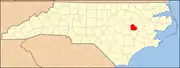 | |
| CDP | ||
| Unincorporated community | ||
This article is issued from Wikipedia. The text is licensed under Creative Commons - Attribution - Sharealike. Additional terms may apply for the media files.