Saint-Étienne-sur-Reyssouze | |
|---|---|
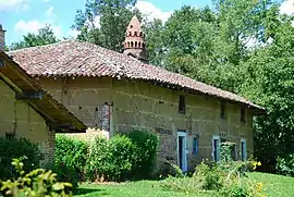 Pérignat farm | |
Location of Saint-Étienne-sur-Reyssouze | |
 Saint-Étienne-sur-Reyssouze  Saint-Étienne-sur-Reyssouze | |
| Coordinates: 46°24′50″N 5°00′06″E / 46.4139°N 5.0017°E | |
| Country | France |
| Region | Auvergne-Rhône-Alpes |
| Department | Ain |
| Arrondissement | Bourg-en-Bresse |
| Canton | Replonges |
| Intercommunality | Bresse et Saône |
| Government | |
| • Mayor (2020–2026) | Jean-Pierre Marguin[1] |
| Area 1 | 13.82 km2 (5.34 sq mi) |
| Population | 581 |
| • Density | 42/km2 (110/sq mi) |
| Time zone | UTC+01:00 (CET) |
| • Summer (DST) | UTC+02:00 (CEST) |
| INSEE/Postal code | 01352 /01190 |
| Elevation | 175–209 m (574–686 ft) (avg. 185 m or 607 ft) |
| 1 French Land Register data, which excludes lakes, ponds, glaciers > 1 km2 (0.386 sq mi or 247 acres) and river estuaries. | |
Saint-Étienne-sur-Reyssouze (French pronunciation: [sɛ̃.t‿etjɛn syʁ ʁɛsuz], literally Saint-Étienne on Reyssouze) is a commune in the Ain department in eastern France.
Population
| Year | Pop. | ±% p.a. |
|---|---|---|
| 1968 | 480 | — |
| 1975 | 409 | −2.26% |
| 1982 | 402 | −0.25% |
| 1990 | 376 | −0.83% |
| 1999 | 386 | +0.29% |
| 2009 | 524 | +3.10% |
| 2014 | 563 | +1.45% |
| 2020 | 586 | +0.67% |
| Source: INSEE[3] | ||
See also
References
- ↑ "Répertoire national des élus: les maires" (in French). data.gouv.fr, Plateforme ouverte des données publiques françaises. 13 September 2022.
- ↑ "Populations légales 2021". The National Institute of Statistics and Economic Studies. 28 December 2023.
- ↑ Population en historique depuis 1968, INSEE
Wikimedia Commons has media related to Saint-Étienne-sur-Reyssouze.
This article is issued from Wikipedia. The text is licensed under Creative Commons - Attribution - Sharealike. Additional terms may apply for the media files.