Six Mile Township | |
|---|---|
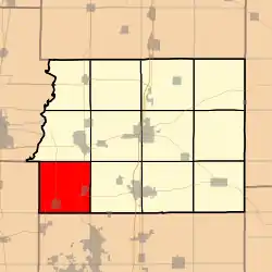 Location in Franklin County | |
 Franklin County's location in Illinois | |
| Coordinates: 37°54′37″N 89°05′26″W / 37.91028°N 89.09056°W | |
| Country | United States |
| State | Illinois |
| County | Franklin |
| Established | November 4, 1884 |
| Area | |
| • Total | 36.83 sq mi (95.4 km2) |
| • Land | 36.14 sq mi (93.6 km2) |
| • Water | 0.69 sq mi (1.8 km2) 1.87% |
| Elevation | 397 ft (121 m) |
| Population (2010) | |
| • Estimate (2016)[1] | 3,786 |
| • Density | 107.5/sq mi (41.5/km2) |
| Time zone | UTC-6 (CST) |
| • Summer (DST) | UTC-5 (CDT) |
| ZIP codes | 62865, 62896, 62983, 62999 |
| FIPS code | 17-055-70070 |
Six Mile Township is one of twelve townships in Franklin County, Illinois, USA. As of the 2010 census, its population was 3,885 and it contained 1,741 housing units.[2]
Geography
According to the 2010 census, the township has a total area of 36.83 square miles (95.4 km2), of which 36.14 square miles (93.6 km2) (or 98.13%) is land and 0.69 square miles (1.8 km2) (or 1.87%) is water.[2]
Cities, towns, villages
Unincorporated towns
- Cleburne
- Mitchell
- New Bush
(This list is based on USGS data and may include former settlements.)
Cemeteries
The township contains these fourteen cemeteries: Browning, Butler, Dawson, Miners (Old), Miners (New), Moyers, Osage, Saint Aloysius, Saint Andrews, Saint Marys, Vaughn, Wells, Zeigler (Old), and Zeigler (New).
Major highways
Airports and landing strips
Lakes
- B And A Lake
- Hilyn Lake
Demographics
| Census | Pop. | Note | %± |
|---|---|---|---|
| 2016 (est.) | 3,786 | [1] | |
| U.S. Decennial Census[6] | |||
School districts
- Zeigler-Royalton Community Unit School District 188
Political districts
- Illinois' 12th congressional district
- State House District 117
- State Senate District 59
References
- "Six Mile Township, Franklin County, Illinois". Geographic Names Information System. United States Geological Survey, United States Department of the Interior. Retrieved January 16, 2010.
- United States Census Bureau 2007 TIGER/Line Shapefiles
- United States National Atlas
- 1 2 "Population and Housing Unit Estimates". Retrieved June 9, 2017.
- 1 2 "Population, Housing Units, Area, and Density: 2010 - County -- County Subdivision and Place -- 2010 Census Summary File 1". United States Census. Archived from the original on February 12, 2020. Retrieved May 28, 2013.
- ↑ Illinois: Airport Locations in Illinois
- ↑ Adams Airport - Illinois - Map and Area Photos
- ↑ Getting to Carbondale: By plane - Illinois Travel Guide - iGuide
- ↑ "Census of Population and Housing". Census.gov. Retrieved June 4, 2016.
External links
Places adjacent to Six Mile Township, Franklin County, Illinois | |
|---|---|
Municipalities and communities of Franklin County, Illinois, United States | ||
|---|---|---|
| Cities | Map of Illinois highlighting Franklin County | |
| Villages | ||
| Townships | ||
| CDP | ||
| Other unincorporated communities | ||
| Footnotes | ‡This populated place also has portions in an adjacent county or counties | |
This article is issued from Wikipedia. The text is licensed under Creative Commons - Attribution - Sharealike. Additional terms may apply for the media files.