South Flannigan Township | |
|---|---|
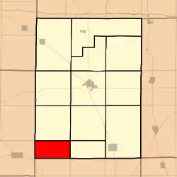 Location in Hamilton County | |
 Hamilton County's location in Illinois | |
| Coordinates: 37°55′50″N 88°39′20″W / 37.93056°N 88.65556°W | |
| Country | |
| State | |
| County | Hamilton |
| Established | November 3, 1885 |
| Area | |
| • Total | 18.41 sq mi (47.7 km2) |
| • Land | 18.38 sq mi (47.6 km2) |
| • Water | 0.04 sq mi (0.1 km2) 0.22% |
| Elevation | 531 ft (162 m) |
| Population (2010) | |
| • Estimate (2016)[1] | 112 |
| • Density | 6.3/sq mi (2.4/km2) |
| Time zone | UTC-6 (CST) |
| • Summer (DST) | UTC-5 (CDT) |
| ZIP codes | 62817, 62890, 62935 |
| FIPS code | 17-065-70785 |
South Flannigan Township is one of twelve townships in Hamilton County, Illinois, USA. As of the 2010 census, its population was 116 and it contained 74 housing units.[2] It was formed from Flannigan Township.
Geography
According to the 2010 census, the township has a total area of 18.41 square miles (47.7 km2), of which 18.38 square miles (47.6 km2) (or 99.84%) is land and 0.04 square miles (0.10 km2) (or 0.22%) is water.[2]
Unincorporated towns
- University at 37°56′11″N 88°36′34″W / 37.936437°N 88.609499°W
(This list is based on USGS data and may include former settlements.)
Cemeteries
The township contains these two cemeteries: Good Hope and Winn.
Demographics
| Census | Pop. | Note | %± |
|---|---|---|---|
| 2016 (est.) | 112 | [1] | |
| U.S. Decennial Census[3] | |||
School districts
- Galatia Community Unit School District 1
- Hamilton County Community Unit School District 10
- Thompsonville Community Unit School District 174
Political districts
- Illinois's 19th congressional district
- State House District 117
- State Senate District 59
References
- "South Flannigan Township, Hamilton County, Illinois". Geographic Names Information System. United States Geological Survey, United States Department of the Interior. Retrieved July 6, 2010.
- United States Census Bureau 2009 TIGER/Line Shapefiles
- United States National Atlas
- 1 2 "Population and Housing Unit Estimates". Retrieved June 9, 2017.
- 1 2 "Population, Housing Units, Area, and Density: 2010 - County -- County Subdivision and Place -- 2010 Census Summary File 1". United States Census. Archived from the original on February 12, 2020. Retrieved May 28, 2013.
- ↑ "Census of Population and Housing". Census.gov. Retrieved June 4, 2016.
External links
- City-Data.com
- Illinois State Archives
- Township Officials of Illinois
- Hamilton County Historical Society
Places adjacent to South Flannigan Township, Hamilton County, Illinois | |
|---|---|
Municipalities and communities of Hamilton County, Illinois, United States | ||
|---|---|---|
| Cities | Map of Illinois highlighting Hamilton County | |
| Town | ||
| Villages | ||
| Townships | ||
| Unincorporated communities | ||
| Footnotes | ‡This populated place also has portions in an adjacent county or counties | |
This article is issued from Wikipedia. The text is licensed under Creative Commons - Attribution - Sharealike. Additional terms may apply for the media files.