Triângulo Mineiro e Alto Paranaíba | |
|---|---|
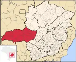 Location of Triângulo Mineiro e Alto Paranaíba | |
| Coordinates: 17°13′19″S 46°52′30″W / 17.22194°S 46.87500°W | |
| Country | |
| Region | Southeast |
| State | |
| Area | |
| • Total | 90,545 km2 (34,960 sq mi) |
| Population (2014/IBGE) | |
| • Total | 2,279,478 |
| • Density | 25.17/km2 (65.2/sq mi) |
| Time zone | UTC-3 (BRT) |
| • Summer (DST) | UTC-2 (BRST) |
Triângulo Mineiro e Alto Paranaíba (transl. Minas Triangle and High Paranaíba) is one of the twelve mesoregions of the Brazilian state of Minas Gerais. It is composed of 66 municipalities[1] distributed across 7 microregions.
References
- ↑ "Produto Interno Bruto dos Municípios" [GDP of the Brazilian Municipalities] (PDF) (in Portuguese). Brazilian Institute of Geography and Statistics (IBGE). 2010-11-01. Archived from the original (PDF) on 2014-04-24. Retrieved 2014-12-23.
This article is issued from Wikipedia. The text is licensed under Creative Commons - Attribution - Sharealike. Additional terms may apply for the media files.