Tulwitz | |
|---|---|
 Remote view of Tulwitz | |
 Coat of arms | |
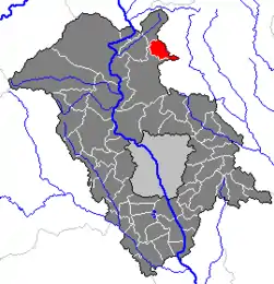 Location within Weiz district | |
 Tulwitz Location within Austria | |
| Coordinates: 47°16′11″N 15°27′38″E / 47.26972°N 15.46056°E | |
| Country | Austria |
| State | Styria |
| District | Weiz |
| Government | |
| • Mayor | Hermann Gschaidbauer (ÖVP) |
| Area | |
| • Total | 11.56 km2 (4.46 sq mi) |
| Elevation | 650 m (2,130 ft) |
| Population (1 January 2016)[1] | |
| • Total | 508 |
| • Density | 44/km2 (110/sq mi) |
| Time zone | UTC+1 (CET) |
| • Summer (DST) | UTC+2 (CEST) |
| Postal code | 8163 |
| Area code | 03179 |
| Vehicle registration | GU |
| Website | www.tulwitz. steiermark.at |
Tulwitz is a former municipality in the district of Graz-Umgebung in the Austrian state of Styria. Since the 2015 Styria municipal structural reform, it is part of the municipality Fladnitz an der Teichalm, in the Weiz District.[2]
Population
| Year | Pop. | ±% |
|---|---|---|
| 1869 | 628 | — |
| 1880 | 652 | +3.8% |
| 1890 | 606 | −7.1% |
| 1900 | 605 | −0.2% |
| 1910 | 616 | +1.8% |
| 1923 | 621 | +0.8% |
| 1934 | 617 | −0.6% |
| 1939 | 590 | −4.4% |
| 1951 | 566 | −4.1% |
| 1961 | 513 | −9.4% |
| 1971 | 517 | +0.8% |
| 1981 | 515 | −0.4% |
| 1991 | 517 | +0.4% |
| 2001 | 500 | −3.3% |
References
This article is issued from Wikipedia. The text is licensed under Creative Commons - Attribution - Sharealike. Additional terms may apply for the media files.