Ermenonville-la-Petite | |
|---|---|
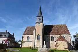 The church in Ermenonville-la-Petite | |
Location of Ermenonville-la-Petite | |
 Ermenonville-la-Petite  Ermenonville-la-Petite | |
| Coordinates: 48°17′48″N 1°21′10″E / 48.2967°N 1.3528°E | |
| Country | France |
| Region | Centre-Val de Loire |
| Department | Eure-et-Loir |
| Arrondissement | Chartres |
| Canton | Illiers-Combray |
| Government | |
| • Mayor (2020–2026) | Vincent Carnis[1] |
| Area 1 | 5.12 km2 (1.98 sq mi) |
| Population | 185 |
| • Density | 36/km2 (94/sq mi) |
| Time zone | UTC+01:00 (CET) |
| • Summer (DST) | UTC+02:00 (CEST) |
| INSEE/Postal code | 28142 /28120 |
| Elevation | 134–162 m (440–531 ft) (avg. 160 m or 520 ft) |
| 1 French Land Register data, which excludes lakes, ponds, glaciers > 1 km2 (0.386 sq mi or 247 acres) and river estuaries. | |
Ermenonville-la-Petite (French pronunciation: [ɛʁmənɔ̃vil la pətit]) is a commune in the Eure-et-Loir department in northern France.
Population
| Year | Pop. | ±% p.a. |
|---|---|---|
| 1968 | 146 | — |
| 1975 | 120 | −2.76% |
| 1982 | 135 | +1.70% |
| 1990 | 160 | +2.15% |
| 1999 | 159 | −0.07% |
| 2009 | 190 | +1.80% |
| 2014 | 179 | −1.19% |
| 2020 | 182 | +0.28% |
| Source: INSEE[3] | ||
See also
References
- ↑ "Répertoire national des élus: les maires" (in French). data.gouv.fr, Plateforme ouverte des données publiques françaises. 4 May 2022.
- ↑ "Populations légales 2021". The National Institute of Statistics and Economic Studies. 28 December 2023.
- ↑ Population en historique depuis 1968, INSEE
Wikimedia Commons has media related to Ermenonville-la-Petite.
This article is issued from Wikipedia. The text is licensed under Creative Commons - Attribution - Sharealike. Additional terms may apply for the media files.