Ormoy | |
|---|---|
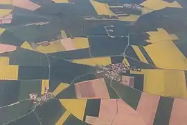 Aerial view (2018) | |
Location of Ormoy | |
 Ormoy  Ormoy | |
| Coordinates: 48°37′18″N 1°28′20″E / 48.6216°N 1.4721°E | |
| Country | France |
| Region | Centre-Val de Loire |
| Department | Eure-et-Loir |
| Arrondissement | Dreux |
| Canton | Dreux-2 |
| Intercommunality | CA Pays de Dreux |
| Government | |
| • Mayor (2020–2026) | Sylvie Challes[1] |
| Area 1 | 9.04 km2 (3.49 sq mi) |
| Population | 223 |
| • Density | 25/km2 (64/sq mi) |
| Time zone | UTC+01:00 (CET) |
| • Summer (DST) | UTC+02:00 (CEST) |
| INSEE/Postal code | 28289 /28210 |
| Elevation | 111–155 m (364–509 ft) (avg. 140 m or 460 ft) |
| 1 French Land Register data, which excludes lakes, ponds, glaciers > 1 km2 (0.386 sq mi or 247 acres) and river estuaries. | |
Ormoy (French pronunciation: [ɔʁmwa] ⓘ) is a commune in the Eure-et-Loir department and Centre-Val de Loire region of north-central France. It lies 20 km north of Chartres and some 70 km west-south-west of Paris.
Population
| Year | Pop. | ±% p.a. |
|---|---|---|
| 1968 | 95 | — |
| 1975 | 100 | +0.74% |
| 1982 | 134 | +4.27% |
| 1990 | 164 | +2.56% |
| 1999 | 180 | +1.04% |
| 2009 | 244 | +3.09% |
| 2014 | 241 | −0.25% |
| 2020 | 219 | −1.58% |
| Source: INSEE[3] | ||
See also
References
- ↑ "Répertoire national des élus: les maires" (in French). data.gouv.fr, Plateforme ouverte des données publiques françaises. 13 September 2022.
- ↑ "Populations légales 2021". The National Institute of Statistics and Economic Studies. 28 December 2023.
- ↑ Population en historique depuis 1968, INSEE
Wikimedia Commons has media related to Ormoy (Eure-et-Loir).
This article is issued from Wikipedia. The text is licensed under Creative Commons - Attribution - Sharealike. Additional terms may apply for the media files.