Osceola Township | |
|---|---|
Township | |
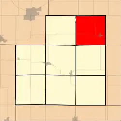 Location in Stark County | |
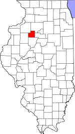 Stark County's location in Illinois | |
| Country | United States |
| State | Illinois |
| County | Stark |
| Established | November 2, 1852 |
| Area | |
| • Total | 35.5 sq mi (92 km2) |
| • Land | 35.49 sq mi (91.9 km2) |
| • Water | 0.01 sq mi (0.03 km2) 0.03% |
| Population (2010) | |
| • Estimate (2016)[1] | 971 |
| • Density | 28.6/sq mi (11.0/km2) |
| Time zone | UTC-6 (CST) |
| • Summer (DST) | UTC-5 (CDT) |
| FIPS code | 17-175-56783 |
Osceola Township is located in Stark County, Illinois. As of the 2010 census, its population was 1,014 and it contained 428 housing units.[2]
Geography
According to the 2010 census, the township has a total area of 35.5 square miles (92 km2), of which 35.49 square miles (91.9 km2) (or 99.97%) is land and 0.01 square miles (0.026 km2) (or 0.03%) is water.[2]
Demographics
| Census | Pop. | Note | %± |
|---|---|---|---|
| 2016 (est.) | 971 | [1] | |
| U.S. Decennial Census[3] | |||
References
- 1 2 "Population and Housing Unit Estimates". Retrieved June 9, 2017.
- 1 2 "Population, Housing Units, Area, and Density: 2010 - County -- County Subdivision and Place -- 2010 Census Summary File 1". United States Census. Archived from the original on February 12, 2020. Retrieved May 28, 2013.
- ↑ "Census of Population and Housing". Census.gov. Retrieved June 4, 2016.
External links
Municipalities and communities of Stark County, Illinois, United States | ||
|---|---|---|
| Cities | Map of Illinois highlighting Stark County | |
| Villages | ||
| Townships | ||
| Unincorporated communities | ||
41°11′11″N 89°41′32″W / 41.18639°N 89.69222°W
This article is issued from Wikipedia. The text is licensed under Creative Commons - Attribution - Sharealike. Additional terms may apply for the media files.