Saint-Marcel | |
|---|---|
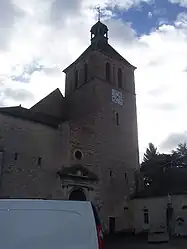 The church in Saint-Marcel | |
 Coat of arms | |
Location of Saint-Marcel | |
 Saint-Marcel  Saint-Marcel | |
| Coordinates: 46°46′35″N 4°53′24″E / 46.7764°N 4.89°E | |
| Country | France |
| Region | Bourgogne-Franche-Comté |
| Department | Saône-et-Loire |
| Arrondissement | Chalon-sur-Saône |
| Canton | Saint-Rémy |
| Intercommunality | CA Le Grand Chalon |
| Government | |
| • Mayor (2020–2026) | Raymond Burdin[1] |
| Area 1 | 10.17 km2 (3.93 sq mi) |
| Population | 6,199 |
| • Density | 610/km2 (1,600/sq mi) |
| Time zone | UTC+01:00 (CET) |
| • Summer (DST) | UTC+02:00 (CEST) |
| INSEE/Postal code | 71445 /71380 |
| Elevation | 172–194 m (564–636 ft) (avg. 181 m or 594 ft) |
| 1 French Land Register data, which excludes lakes, ponds, glaciers > 1 km2 (0.386 sq mi or 247 acres) and river estuaries. | |
Saint-Marcel is a commune in the Saône-et-Loire department in the region of Bourgogne-Franche-Comté in eastern France. Among its notable buildings is the Abbey of Saint-Marcel-lès-Chalon.

Town hall
Population
| Year | Pop. | ±% p.a. |
|---|---|---|
| 1968 | 3,516 | — |
| 1975 | 4,253 | +2.76% |
| 1982 | 3,973 | −0.97% |
| 1990 | 4,118 | +0.45% |
| 1999 | 4,705 | +1.49% |
| 2007 | 5,669 | +2.36% |
| 2012 | 5,932 | +0.91% |
| 2017 | 6,049 | +0.39% |
| Source: INSEE[3] | ||
See also
References
- ↑ "Répertoire national des élus: les maires". data.gouv.fr, Plateforme ouverte des données publiques françaises (in French). 2 December 2020.
- ↑ "Populations légales 2021". The National Institute of Statistics and Economic Studies. 28 December 2023.
- ↑ Population en historique depuis 1968, INSEE
Wikimedia Commons has media related to Saint-Marcel (Saône-et-Loire).
This article is issued from Wikipedia. The text is licensed under Creative Commons - Attribution - Sharealike. Additional terms may apply for the media files.