Saint-Pierre-le-Vieux | |
|---|---|
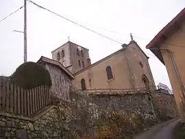 The church in Saint-Pierre-le-Vieux | |
Location of Saint-Pierre-le-Vieux | |
 Saint-Pierre-le-Vieux  Saint-Pierre-le-Vieux | |
| Coordinates: 46°17′10″N 4°32′13″E / 46.2861°N 4.5369°E | |
| Country | France |
| Region | Bourgogne-Franche-Comté |
| Department | Saône-et-Loire |
| Arrondissement | Mâcon |
| Canton | La Chapelle-de-Guinchay |
| Government | |
| • Mayor (2020–2026) | Cedric Grandperret[1] |
| Area 1 | 15.79 km2 (6.10 sq mi) |
| Population | 373 |
| • Density | 24/km2 (61/sq mi) |
| Time zone | UTC+01:00 (CET) |
| • Summer (DST) | UTC+02:00 (CEST) |
| INSEE/Postal code | 71469 /71520 |
| Elevation | 318–638 m (1,043–2,093 ft) (avg. 358 m or 1,175 ft) |
| 1 French Land Register data, which excludes lakes, ponds, glaciers > 1 km2 (0.386 sq mi or 247 acres) and river estuaries. | |
Saint-Pierre-le-Vieux (French pronunciation: [sɛ̃ pjɛʁ lə vjø]) is a commune in the Saône-et-Loire department in the region of Bourgogne-Franche-Comté in eastern France.
Geography
The Grosne flows northeastward through the middle of the commune and crosses the village.
See also
References
- ↑ "Répertoire national des élus: les maires" (in French). data.gouv.fr, Plateforme ouverte des données publiques françaises. 13 September 2022.
- ↑ "Populations légales 2021". The National Institute of Statistics and Economic Studies. 28 December 2023.
Wikimedia Commons has media related to Saint-Pierre-le-Vieux (Saône-et-Loire).
This article is issued from Wikipedia. The text is licensed under Creative Commons - Attribution - Sharealike. Additional terms may apply for the media files.