Méréville | |
|---|---|
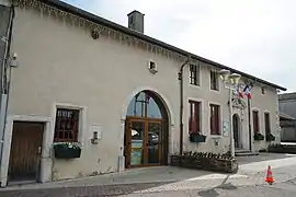 The town hall in Méréville | |
 Coat of arms | |
Location of Méréville | |
 Méréville  Méréville | |
| Coordinates: 48°35′34″N 6°09′11″E / 48.5928°N 6.1531°E | |
| Country | France |
| Region | Grand Est |
| Department | Meurthe-et-Moselle |
| Arrondissement | Nancy |
| Canton | Neuves-Maisons |
| Intercommunality | Moselle et Madon |
| Government | |
| • Mayor (2020–2026) | Cédric Schwaederle[1] |
| Area 1 | 8.43 km2 (3.25 sq mi) |
| Population | 1,288 |
| • Density | 150/km2 (400/sq mi) |
| Time zone | UTC+01:00 (CET) |
| • Summer (DST) | UTC+02:00 (CEST) |
| INSEE/Postal code | 54364 /54850 |
| Elevation | 218–343 m (715–1,125 ft) (avg. 240 m or 790 ft) |
| 1 French Land Register data, which excludes lakes, ponds, glaciers > 1 km2 (0.386 sq mi or 247 acres) and river estuaries. | |
Méréville (French pronunciation: [meʁevil] ⓘ) is a commune in the Meurthe-et-Moselle department in north-eastern France.
Geography
The river Madon flows through the commune.
See also
References
- ↑ "Répertoire national des élus: les maires" (in French). data.gouv.fr, Plateforme ouverte des données publiques françaises. 13 September 2022.
- ↑ "Populations légales 2021". The National Institute of Statistics and Economic Studies. 28 December 2023.
Wikimedia Commons has media related to Méréville (Meurthe-et-Moselle).
This article is issued from Wikipedia. The text is licensed under Creative Commons - Attribution - Sharealike. Additional terms may apply for the media files.